Delaware prepares for sea level rise
May 24th, 2013
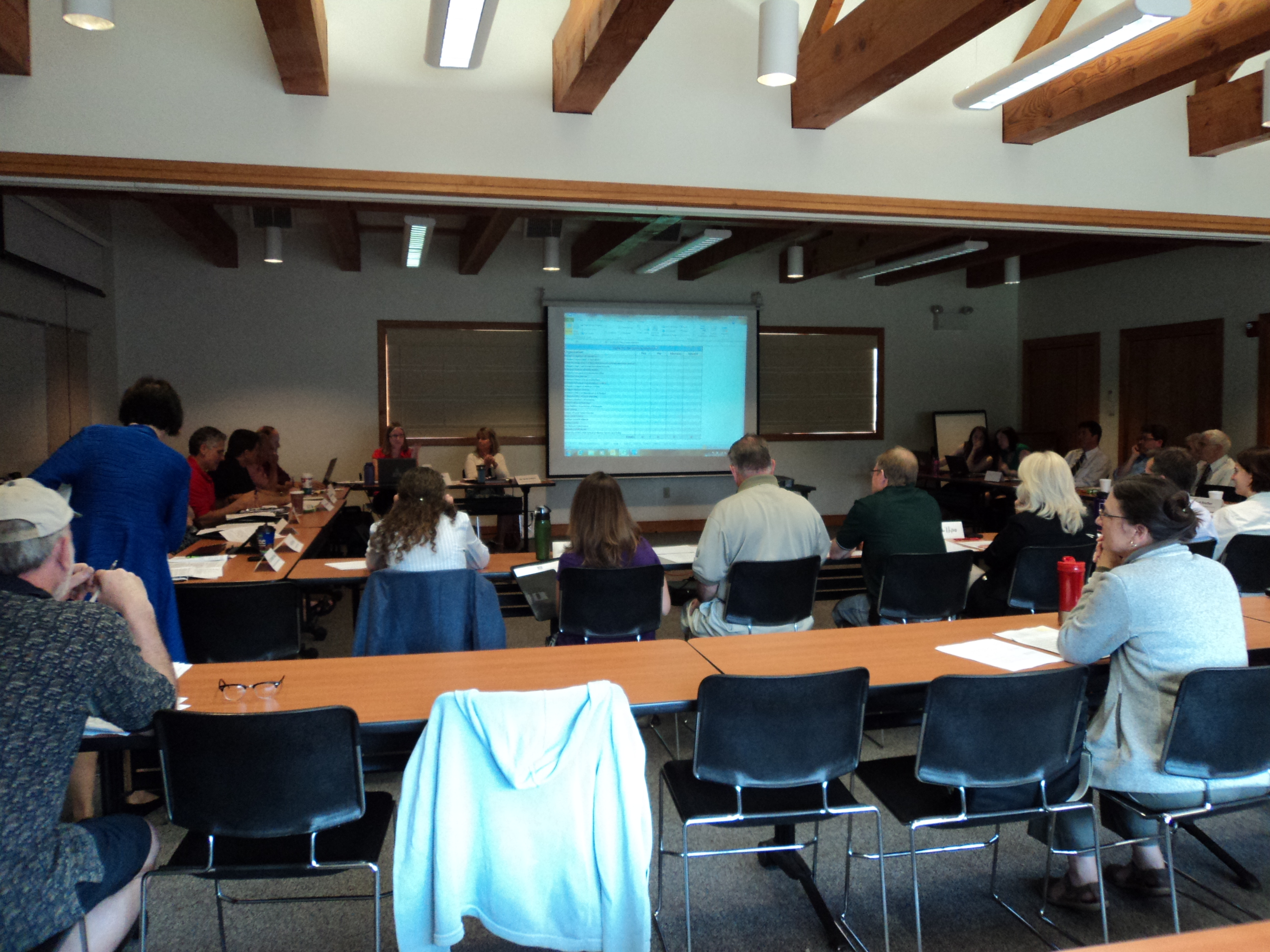
Yesterday was a meeting of the Delaware Sea Level Rise Advisory Committee at Kitts Hummock, by Dover. Their charge is broad:
“…potential solutions to reduce risk to sea level rise impacts…” but they’re missing the boat in at least one obvious area…
The reality of sea level rise is apparent every time I head up to Delaware City, because Route 9 is underwater, from 1/3 to 2/3 of the southbound lane. When we headed to Kitts Hummuck (what’s a hummuck? “It’s like a tussock, but bigger,” Alan says.) and there was water on Route 9 south of Port Penn, too. Delaware is SO flat, and Port Penn’s development has moved back from water’s edge:

In looking at the draft report, the first thing I noticed was that there was nothing about preparation about how sea level rise would affect utility infrastructure (the love of my life!). During a break, the DOT rep at the meeting let me know that they’d done a “Vulnerability Study” that addresses that, and here it is:
.. and no, there’s nothing about electrical infrastructure, ranging from generation, to transmission, to distribution. A search shows only one reference to electrical:
Data Collection
In order to conduct an in-depth vulnerability assessment, geographic datasets are necessary. Geographic datasets are a special type of dataset that contains information so that it can be placed on a map. Delaware Coastal Programs staff spent considerable time and effort compiling geographic datasets that could be utilized
with the sea level rise scenario maps to determine the location and numbers of resources at risk from sea
level rise. Datasets like roads, railways and public safety facilities were relatively easy to obtain as they are
maintained and routinely updated by a state or county agency. Many datasets were out of date or lacked
appropriate documentation as to when the data was collected or how it was collected (metadata). A few
datasets were unable to be used for this assessment due to privacy or homeland security concerns (electrical
substations for example). In many other cases, the desired data did not exist or was so out of date that it could
not be used.
Oh my… ummmmmmm… what a bunch ‘o crap! They need to look at this stuff, and for sure they have access. They are a government entity doing planning. EARTH TO MARS — all they have to do is sign a form, and if they don’t want to do that, they can look at google maps. THERE IS NO EXCUSE FOR THIS.
Why does it matter whether they consider electrical infrastructure? Well, electricity is deemed an essential service, and if it’s underwater, they’re gonna have problems, to put it mildly. Power plants are typically located on water, Indian River is a perfect example, sited on the Indian River Bay, just off the ocean, and about a foot above the water level:

What do they say about the Indian River power plant? This is it:
The Indian River power plant is the only heavy industrial facility permitted by the Coastal Zone Act in Sussex
County. This facility’s disposal area, shoreline, and intake structures are within areas that will be inundated by sea level rise, but the power plant itself is not within a potential inundation area.
Otherwise, power plants are addressed only in terms of impact of loss of rail service. Great…
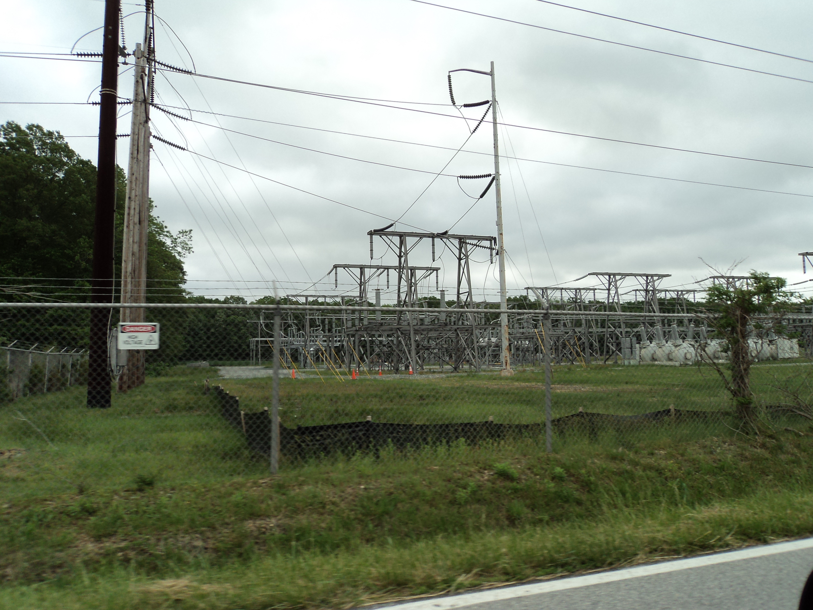
Here’s a photo I took of one of the substations they’re ignoring — took this photo while flying by on Route 9, close to Kitts Hummock. I saw this substation, there’s no reason they can’t, and when this substation goes underwater, then what? A state with homes as old as ours should have an understanding of long-term planning (it looks to me that this was built in anticipation of MAPP, it’s huge and has a lot of empty positions:
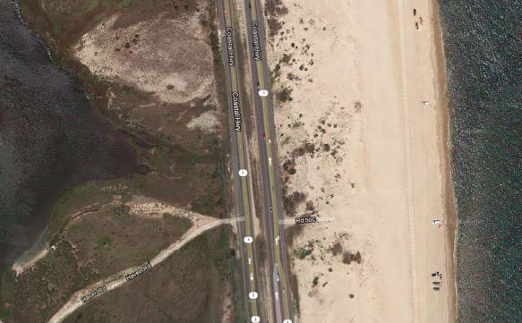
The only transmission considered is disease transmission. An example of transmission facilities at issue is the one along Hwy. 1, by Indian River, pictured here where the Bay is on the west (left), the transmission line is immediately adjacent to the southbound lane of Hwy. 1, and the ocean is east of Hwy. 1:
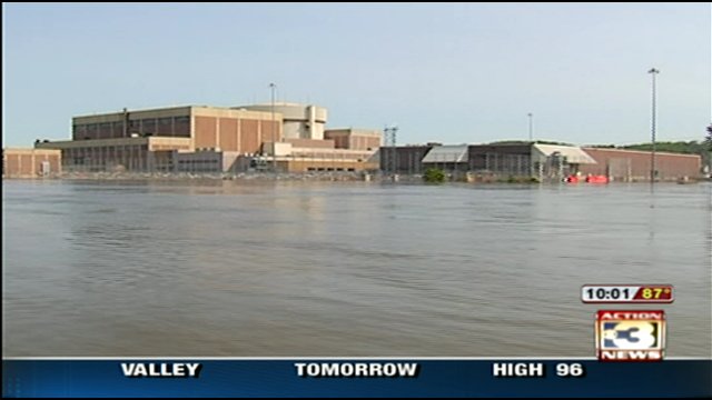
Nuclear is not mentioned, despite the three reactor Salem and Hope Creek plant just across the Delaware Bay. With sea level rise, it will soon look like Ft. Calhoun:
Here’s what they have to say about pipelines, p. 101 of Vulnerability Assessment — they’re not concerned:
Underground Pipeline Utilities: This resource includes natural gas and petroleum pipelines. Workgroup
members also initially considered water and sewer pipelines; however, data was unavailable due to privacy and homeland security concerns. Between 4% and 6% of pipeline utilities throughout the state are within an area that could be inundated by sea level rise by the year 2100. While sections of pipeline are exposed in all three counties, the highest concentration is found in New Castle County. The results from the analysis showed that major supply lines will not be affected; however, distribution along with pipeline corrosion may become issues in the future. Due to these considerations, inundation of underground pipeline utilities is of low concern at this time.
Despite the significant omissions, look at all the Delaware organizations that supported it:
Anyway, then yesterday, they approved the recommendations, with a few minor changes. And those recommendations are not posted — the most recent minutes are from March… sigh…
So rough and quick and dirty review of what they did:
- Approved the lion’s share of the recommendations;
- Deleted #17, which was focused on financial assurance to minimize the state’s liability. GRRRRRR!
- Approved #35 which shifts the burden of notice/disclosure to a home buyer, rather than on a seller and/or realtor. This is SO WRONG!
- Sussex County rep was worthless, sat there silently except to abstain from voting. ?????
From the News Journal:
Saving Delaware’s coast from sea-level rise
Sussex declines to vote on proposed sea-level rise responses
OMara issued a statement Thursday night in response to the countys decision.