Eye of Hurricane Sandy tracks near Port Penn
October 29th, 2012
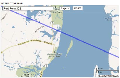
The eye of Hurricane Sandy is expected to hit Delaware tonight and run across the state starting about one mile or less from Port Penn, Delaware. That’s where our house is and a little too close for comfort. Port Penn, is a small village, where 9 intersects with Market, around market to the corner where 9 heads south on Congress. We’re just south of Market a block east of where 9 connects. That the little peninsula on the lower right is “Artificial Island” where there are THREE nuclear reactors. Hurricane Sandy is coming in about a mile north of the reactors, and about a mile north of Port Penn. State Rd. 9 is the one that floods all the time and is often closed.
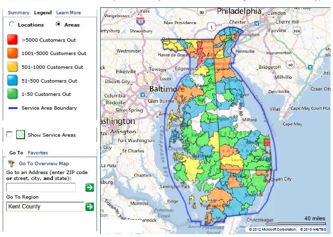
Power outages as of early Monday evening:
Delaware has been declared a disaster area, there’s already lots of flooding and waves coming in over the boardwalk on the southern beaches.
Sandy picks up speed; Obama declares disaster area for Delaware
Power is out north of the canal:
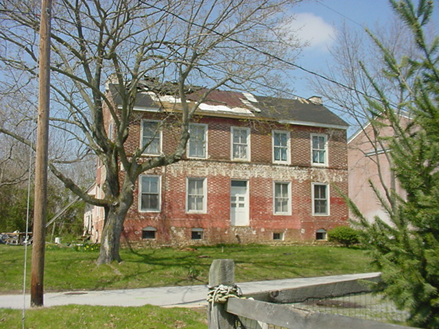
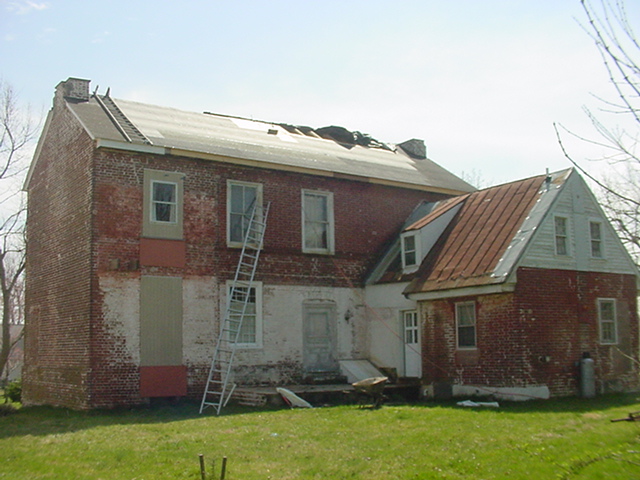
The good news is that the house has been standing since 1742, the historical Steward House, and it’s now got a solidly reinforced new roof (and what a pain in the patoot that was!). But there are a lot of windows pointing towards the Delaware Bay and directly into the oncoming path of hurricane Sandy.
Hope all’s well when we get there in a month or so! Thankfully we’ve got the best neighbors on the planet who will keep us posted.
Delaware — batten the hatches!
October 26th, 2012
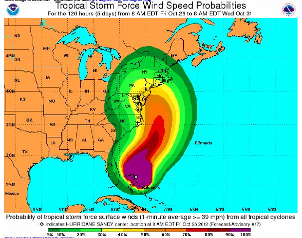
Hurricane Sandy on collision course with Mid-Atlantic and Northeast
Here’s NOAA’s trajectory, Delaware’s right in the middle:
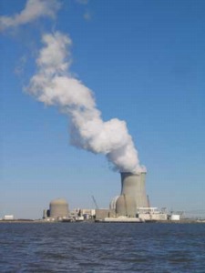
Also right in the middle are the nuclear plants:
In Delaware, we’re in Port Penn, right on the Delaware River across from the Salem and Hope Creek nuclear reactors, as it turns into the Delaware Bay. Here’s what it looks like from above, click for larger jpeg, the “A” is Port Penn, the phallic land mass on the right is “Artificial Island” where the plants are, a sand dune out in the bay sucking the little fish into the cooling system:
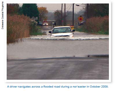
If the hurricane comes through, right up the Bay, we’re in a world of hurt. It is SO flat there, not at all like the bluffs I’m used to. If you go to google earth, and even on this satellite photo, you can see where the village used to be — it originally was a few blocks out into the water, and Alan thinks that it was a lot lower level than it is now. There were dikes built, using slave labor to build it (Delaware is the south, remains, per Alan, a plantation state), homes were out there on stilts, salt hay growing to feed the animals, and all that is gone but some fragments of the pier pilings. You can see the street next to the water, we’re the second existing street over, so that helps some, but the water level is right up near the surface, the geothermal bubbles up, and septic systems are a nightmare. There are floods regularly, and State Road 9 out of town to the north is often covered in spring, and half covered other times, the roads are frequently closed to the north and south. Here’s coming in to town on State Road 9 from the North (photo from DNREC report below):
This is how it is NOW! If the water level goes up, then what? If there are more storms of higher intensity, then what?
Delaware is a state that is wisely planning for rising sea level:
… and here’s their plan:
Preparing for Tomorrow’s High Tide: Sea Level Rise Vulnerability Assessment for the State of Delaware Published July 30, 2012
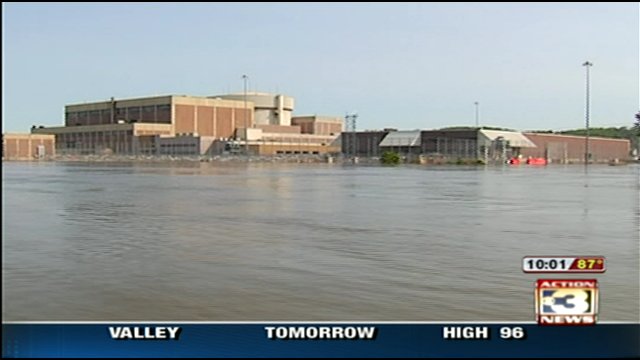
I checked, did a search, and “nuclear” is not mentioned. Ummmmm… hello? Remember the Ft. Calhoun nuclear plant (extra credit if you know anything about the Ft. Calhoun interface!)?
Prairie Island Uprate – who needs it???
October 26th, 2012
Xcel is now admitting they don’t need the Prairie Island uprate:
It’s something even they can’t ignore:
This new information stems from our most recent refueling outage at PI, where the extended outage allows us to modify the schedule for future refueling outages. This change further and materially reduces the anticipated benefits of the PI uprates, which had already been substantially reduced from those predicted in the Certificate of Need case authorizing the uprates. …We note that, in light of the total system costs, $10 million PVRR is not a meaningful difference. In essence, before considering risk factors, the Strategist model does not draw a clear distinction between the two scenarios, thus no longer identifies a clear benefit associated with implementation of the uprates.
They go on and state it more directly:
Our updated plan agreed with the Department of Commerce’s recommendation of a 400 to 600 MW need, which would accommodate a decision to not proceed with the uprates.
…
As a result, we conclude that a decision not to proceed with the uprates would in no way pose risk to customers of an insufficient supply to meet their needs.
…
At this point, we believe it is reasonable to conclude that further investment in the project will not benefit our customers.
…
Based on these considerations, we conclude that the risks of the project outweigh the expected benefits, and customers would be better off if this project did not proceed.
I’m not sure that’s clear enough for the PUC, it’s on the agenda and Staff isn’t clear in their recommendation. Alan and I fired this off Tuesday:
To access the uprate docket, GO HERE and plug in dockets 08-509 and 08-510. Note they’re “08” dockets, which was after the electric crash, but before they admitted demand was down and before we had such a good record of demand going down, staying down, down, down.
Xcel Energy’s sales down AGAIN
October 25th, 2012
I love it when this happens. Yet again, Xcel demonstrates that demand is DOWN.
DOWN!
Here is their Sales (Decline) info (click for larger graphic):
And check wholesale sales — and be prepared for increases when CapX 2020 is up and running:
Transmission? It’s NOT needed!!!
October 18th, 2012
Yes, once more with feeling… this transmission? It’s NOT needed!
Here’s an article from the St. Cloud Times, good to know they’re following up on the CapX 2020 transmission project and keeping an eye on Xcel Energy. This demonstrates what we’ve been saying for how long now? CapX 2020 is NOT needed:
Record hot summer didn’t mean record electricity useage, Xcel Energy reports
In fact, electricity use actually fell in the scorching summer of 2012.
