Northfield AUAR Comments due soon!
February 22nd, 2023
COMMENTS DUE BY MARCH 2, 2023
Xcel-Northfield-AUAR_Scoping-EAW_20230127
Send comments to Mikayla.Schmidt@ci.northfield.mn.us and Jacob.N.Andre@xcelenergy.com
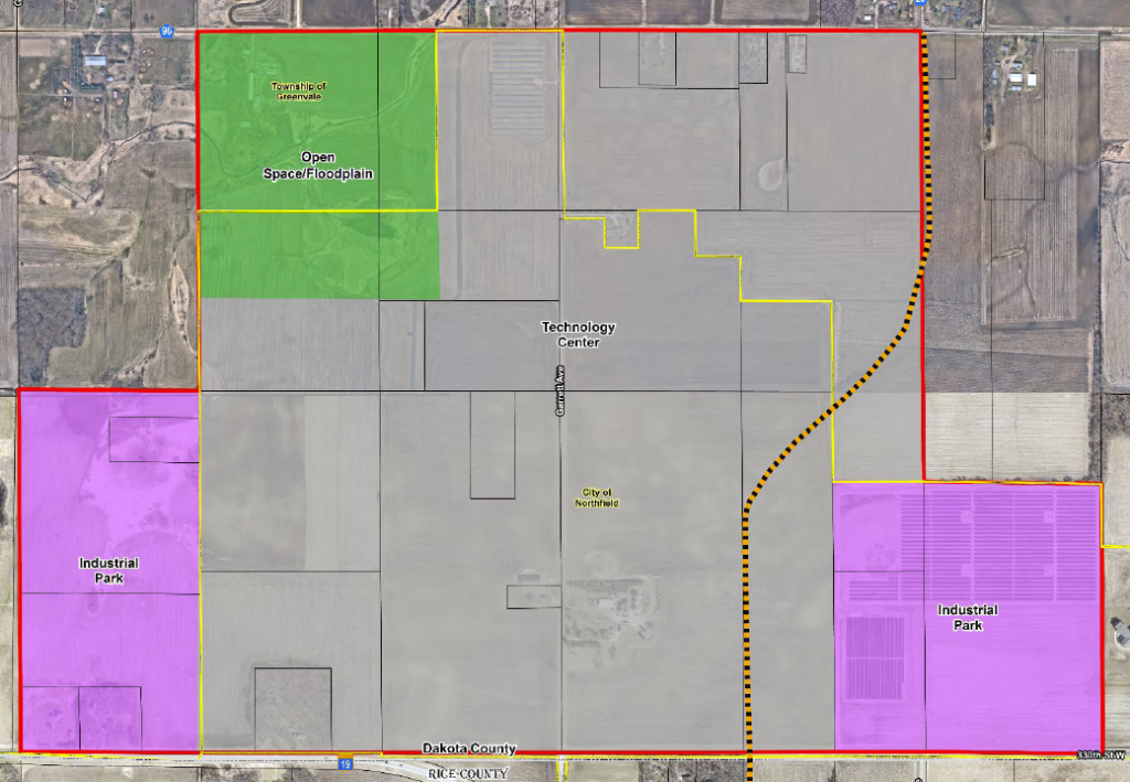
Xcel Energy is proposing changing land use just north and northwest of Northfield, adjacent to the hospital to the east, and along Hwy 19 on the southeast corner. That Xcel Energy is the proposer is significant, as “Development Scenario A: Technology Center” means a data center that would use LOADS of electricity. “Development Scenario B: Industrial Park” just doesn’t have the same Xcel Energy fingerprints on it, but of course it’s an “alternative.” Data centers use a LOT of electricity, certainly a goal of Xcel.
Remembering all the uproar about rezoning at Co. Rd. 1 adjacent to, on west side of, I-35, which has not been developed, now why this, and why there? With all the residential to the south and east of this AUAR, and the EAW notes that some of the area in question was identified in the “2011 Business and Industrial Master Plan” for “larger-scaled, industrial and corporate office use.” SCAN THE PLAN!
Note that it’s up against the hospital. A data center and industrial park seems a bit different than “industrial and corporate office use.”
Here’s the Scoping EAW from Xcel, with RGU City of Northfield — read it and consider:
What’s to consider? For comments, this is “scoping,” so it’s more of a laundry list of what’s missing, what’s been raised but needs more in-depth info, what’s inconsistent with Northfield’s land use plans, and to comment as specifically as possible. A “NOT HERE” or “I DON”T LIKE THIS” won’t cut it.
What to comment on? As is noted in the AUAR EAW, “Comments should address the accuracy and completeness of information, potential impacts that warrant further investigation and the need for an EIS.”
When I think of a data center, I think of the inherent energy sucking nature and the extreme noise, and I am reminded of the significant drainage and erosion problems in the Wisconsin solar projects — impervious surface of roads, driveways, buildings, that’s a problem (does anyone remember the drainage issues with “Grant Park” and the “Presidential” subdivision by the school?).
Regarding energy use, what’s the transmission and distribution system there? Don’t know !I went out there yesterday to have a look, but it was hard to see in the developing blizzard! Snowplow cam from about half an hour after I went through this intersection:
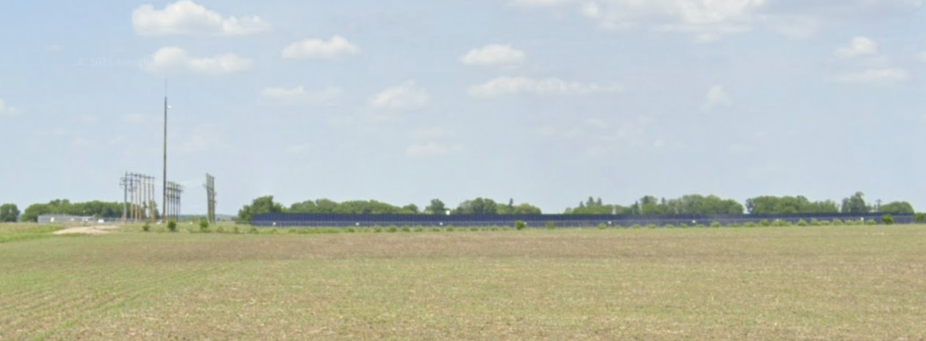
Couldn’t take decent photos, but a reconnoiter showed that there was no apparent transmission lines in, just a low kV line across the top, along 320th Street. Would that be sufficient? I sent a data request to Xcel and Northfield January 31st, but crickets. in 2002 or so, peak load for Northfield was 35MW or so, and I’d guess now it’s about the same, given efficiency gains over the years and lower demand generally.
See the 2011 Business and INdustrial Park Plan, below for some clues on what’s needed.
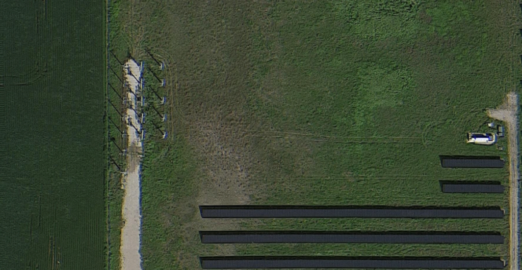
Here’s what the area looks like now — corn & beans and beans & corn. Note that there is a small solar array at the center of the upper boundary, and a larger array of solar in the southeast corner:
Water: Drainage, water lines in, sewer and stormwater out… Wasn’t it a $430,000 or so water, sewer, and storm system extension needed for Target, circa 1998, extending the city’s system south, and paid for, subsidized, by the City? What all would be needed and who is paying for it? See that 2011 Plan, linked below.
What would increasing impervious surfaces with roads, driveways, and buildings, do to the drainage in the area? What extent of storm system would be needed, and where would that water go? Storm system, again, see that 2011 Plan…
Traffic is likely an issue, because there’s often backup on Hwy. 19 with the trucks lined up to drop at McLane. Adding industry to the north of Hwy 19 not much further west could add to the backup, and they’d need more room at the Big Steer, eh? Oh, it’s a Flying J now…
How about that energy suck? Where would electricity come from? There is a low kW line paralleling 320th Street, 69kV or maybe just a 34.5kV distribution, to which the small solar field connects, at the intersection here, is new, so I presume it was added for interconnection. Now, what’s to the west?
In the solar project along North Ave (Co. 39) there’s a solar collector substation, but I’ll have to go out again for a drive-by and get photos of the transmission on site and nearby, and of course, read the 2011 Plan:
The 2011 “Business and Industrial Master Plan” specifically addresses many of the issues, i.e., detailed specifics of what would be needed to bring water in to this site, where electricity and gas would come from, etc. Do check it out.
As noticed in the EQB Monitor, January 31, 2023:
Xcel Energy/ City of Northfield AUAR
Location: Northfield, Dakota County
Process: Alternative urban areawide review (AUAR)
Step: Draft order of review
End of comment period: March 2, 2023
Project description: Xcel Energy and the City of Northfield are partnering to conduct an
Alternative Urban Areawide Review (AUAR) for an approximately 787-acre area in the
northwestern portion of the City of Northfield. Portions of the AUAR area include land
within Greenvale Township. Two development scenarios will be evaluated as part of the
AUAR which primarily consist of technology center and industrial park uses. Additional
steps are required to initiate the AUAR process for certain large projects, which include a
public comment period on the scope of the AUAR. This Scoping Document is available for
review and comment as part of the AUAR process in accordance with Minnesota Rules,
part 4410.3610, subpart 5a.
Link to public documents: Excel (sic) Energy / City of Northfield draft order of review
Location of public documents: Northfield City Hall, 801 Washington Street, Northfield, MN 55057
Responsible governmental unit and contact: City of Northfield, Mikayla Schmidt, 507-645-3059
p. 3 of 7 https://www.eqb.state.mn.us/sites/default/files/documents/January%2031%2C%202023.pdf
What to comment on? Again, read it, do a term search for what you’re interested in, and think broadly but in detail. “Comments should address the accuracy and completeness of information, potential impacts that warrant further investigation and the need for an EIS.”
COMMENTS DUE BY MARCH 2, 2023
Send comments to both Northfield, the RGU, and I’d also send to Xcel Energy so they know you’re paying attention:
Once more with feeling, here’s the scoping notice/EAW and proposal:
And again, the 2011 “Business and Industrial Master Plan” — it’s very well done:
From the Business-and-Inustrial-Park-Master-Plan: — is the Xcel Energy proposal consistent with the 2011 Plan? Does the Xcel plan line up with the phasing, and are the steps toward development incorporated into Xcel’s plan?
We could use this level of planning in Red Wing!
Northfield – Letter to Editor
March 22nd, 2022
In the Northfield News today:


