WRAO & WIRES docs removed from ATC site
September 18th, 2016
Here’s to preservation, download quick to have this bit of history:
| WRAO Report on Transmission System Reinforcement in Wisconsin | File Size | Document |
| Letter of Transmittal to PSCW | 22.8KB | PDF: 1 page |
| Report (without attachments) | 256KB | PDF: 33 pages |
| Attachment A1 – WIREs Phase II Study Report | 391KB | PDF: 79 pages |
| Attachment A2 – WIREs Phase II Study Report (AppendixB) | 2,181KB | PDF: 100 pages |
| Attachment B – Environmental Review of Phase II WIRE Study for the WRAO
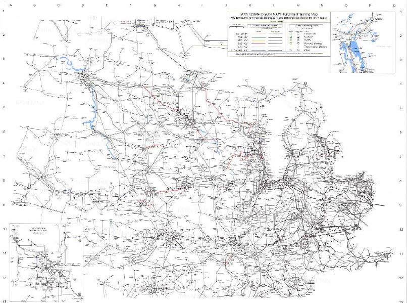
Study area map (summary_map.jpg) 1C Salem – Fitchburg – NorthMadison/Rockdale Analysis 2E Prairie Island – La Crosse – Columbia Analysis 3J Arrowhead – Weston Analysis 5A&B Chisago-Weston (345 kv) & Apple River – Weston (230 kV) Analysis 9B Lakefield Junction – Adams – Columbia Analysis 10 King – Eau Claire – Weston Analysis |
– | Web Page |
| Attachment C – Wisconsin’s Electric Transmission Interconnection Capacity Requirements | 120KB | PDF: 15 pages |
| Attachment D – White Paper on the Requirement for Geographic Diversity in Transmission Line Route Selection for System Reliability | 5,910KB | PDF: 41 pages |
| Attachement E – Stakeholder Comments | 188KB | PDF: 70 pages |
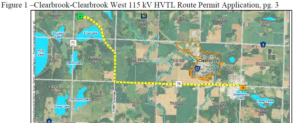
Withdrawal of Clearbrook transmission line!!!
September 13th, 2016
Just in (well, it came in a while ago, but I was being tortured at the U of M Dental Clinic):
YES!! Now, a quick Comment for the record, essentially a thank you note, PUC staff Briefing Papers, a Commission meeting, and Clearbrook is DONE!
Sandpiper Withdrawal? Comments filed today!
September 12th, 2016

Today was Deadline #1 for Comments on NDPC’s Petition for Withdrawal of the Sandpiper pipeline Certificate of Need and Route applications. Here’s what was filed:
Yup, that’s it. My Sandpiper transmission clients weighed in. I’ve been watching the docket, watching the inbox for service…. NO other comments, nothing, nada…
Just get to it. Quick – take a few minutes and send a missive to the Public Utilities Commission encouraging them to allow Enbridge to withdraw their application for the Sandpiper pipeline WITH PREJUDICE so that they can’t refile it again. Send to:
Daniel P. Wolf, Executive Secretary (dan.wolf@state.mn.us) Minnesota Public Utilities Commission 121 Seventh Place East, Suite 350 Saint Paul, MN 55101-2147
Ann O’Reilly and James La Fave, Administrative Law Judges
Office of Administrative Hearings
600 North Robert Street
P.O. Box 64620
St. Paul, MN 55164-0620
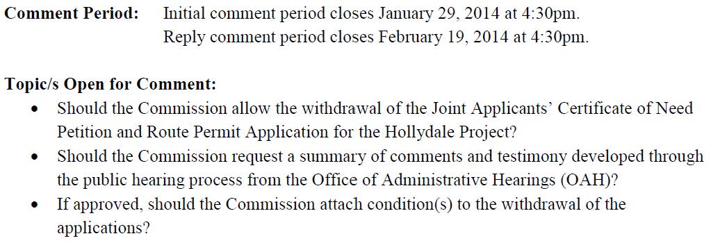
But it doesn’t end there, with zip comments… it gets weirder. I’d saw there was no notice from the PUC about a comment period, nothing. Here’s what they did with Hollydale, Notice, and there was a comment period and reply comments! In that docket, Xcel Energy filed to withdraw its Hollydale applications on December 10, 2013, and this notice was issued on January 10, 2014:
Here’s what we got:
And when I asked:
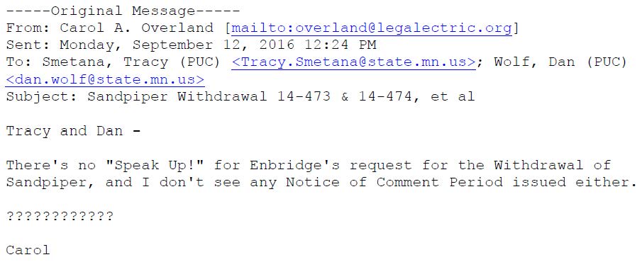
Here’s the response:
Oh my… what do I do with that? Guess I write a post about it!!!
Sandpiper EIS on HOLD!
August 26th, 2016

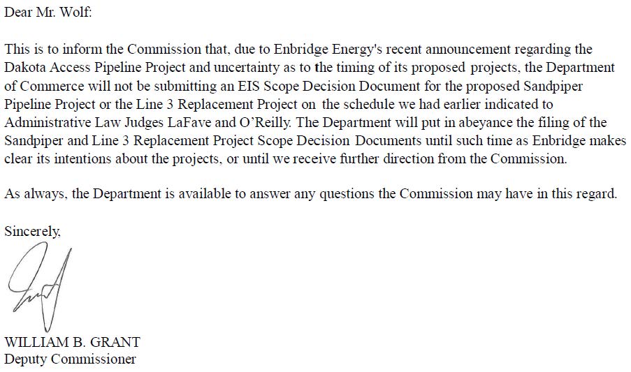
The Department of Commerce has hit the brakes on Sandpiper Pipeline and Line 3 Replacement Projects “until such time as Enbridge makes clear its intentions about the projects, or until we receive further direction from the Commission.”
Here’s the letter from Bill Grant:
20168-124424-01_Commerce_EIS Scope Decision Document on HOLD
And the guts of it:
YES!!! Now, about those transmission lines proposed for pumping stations related to these projects????
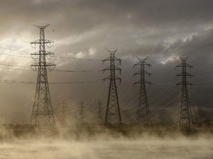
Transmission…
August 21st, 2016
In the inbox today from an activist cohort, a poem by Thomas Lux:
Cucumber Fields Crossed by High Tension Wires
The high-tension spires spike the sky
beneath which boys bend
to pick from prickly vines
the deep-sopped fruit, the rind’s green
a green sunk
in green. They part the plants’ leaves,
reach into the nest,
and pull out mother, father, fat Uncle Phil.
The smaller yellow-green children stay,
for now. The fruit goes
in baskets by the side of the row,
every thirty feet or so. By these bushels
the boys get paid, in cash,
at day’s end, this summer
of the last days of the empire
that will become known as
the past, adios, then,
the ragged-edged beautiful blink.
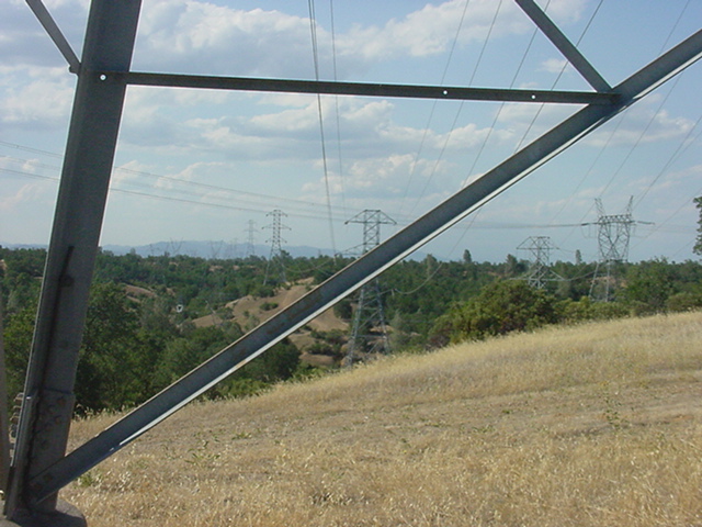
What surprises me is when someone notices transmission, and in this case, Lux is jarred enough to think and write about it. It’s such a common part of our landscape that most people don’t notice it… that is, most people don’t notice it until they’re affected, and suddenly wake up to the reality of transmission, criss-crossing our country with its insidious web, noticing that it’s EVERYWHERE! Once your eyes are opened to transmission, it’s impossible to disregard.