Hydro power, old generation flooding the Great Plains
May 27th, 2016
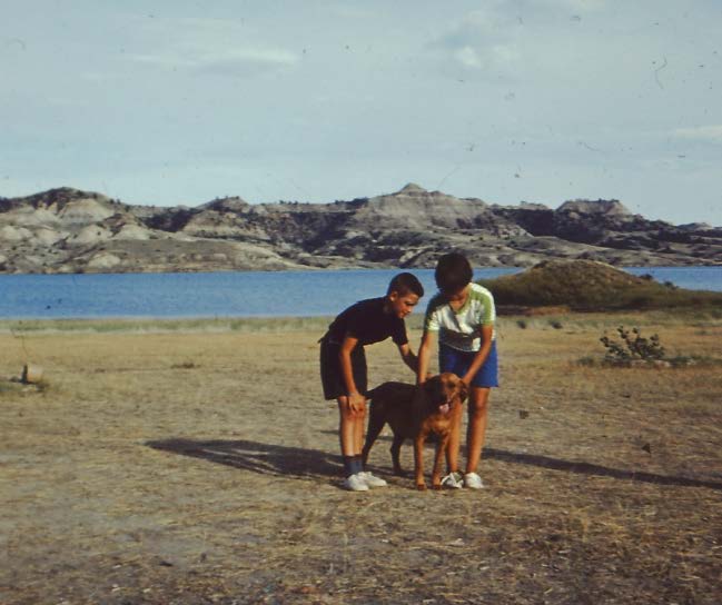
50 years ago, on a family vacation, we went to Ft. Peck, stayed at Hell Creek State Park, which more than lived up to its name then, with miles and miles of nothingness, except for the Park Ranger and his trusty pup. He’d spent his day shooting rattlesnakes, he had a bagfull of them, and showed them to us, advising that we keep an eye open! The coolest, and hottest, camping experience ever. So of course I’ve wanted to go back, and this is the perfect time. It’s cool at night, and it had rained the night before, and it was SO green, blinding, and not at all like the desolate wasteland I’d remembered. Same spot 50 years later… (how did THAT happen?)
![20160525_172116[1]](https://legalectric.org/f/2016/05/20160525_1721161.jpg)
The park is in a pickle, seems there’s no money available for needed improvements, like a single phase line that’s at capacity (AACK, just found a tick! Now it’s a dead tick!), septic over capacity, and tens of thousands of folks come there to fish. They put together a “Master Plan” but it wasn’t clear the purpose, and instead of being a Master Plan, I think it was a way to set out the issues facing the Park and to try to figure out what to do about it.
Hell Creek State Park (Montana) – Comments due 11/25
I don’t get it, it’s a foreign world to me. Everyone there had a big honkin’ pick up truck, and a 5th wheel and towing a big boat that probably cost more than my house! And if they didn’t have the three part rig, they pulled a YUGE trailer and a friend pulled the YUGE fishing boat. To get there, it’s a 26 mile drive over washboard gravel, with so much dust that I don’t know if it will ever come out of the van. Washing it might induce a mudslide!
Not all that far away in miles, but a trip out and back over that long dirt road, is the Ft. Peck dam and power house, and so of course I called up and arranged a tour. Very cool, but no photos allowed. I recognized the museum, the first part of the tour, from 50 years ago, back in the days when we took family “utility infrastructure” trips. And guess who worked on the dam?
![20160524_151925[1]](https://legalectric.org/f/2016/05/20160524_1519251.jpg) There are two power houses, one, the oldest, with three turbines and a 105 nameplate capacity, and two in power house #2, which have a 80 MW capacity. One of the turbines in unit 1 is being replaced, is much smaller, but will be much more efficient and have a higher capacity.
There are two power houses, one, the oldest, with three turbines and a 105 nameplate capacity, and two in power house #2, which have a 80 MW capacity. One of the turbines in unit 1 is being replaced, is much smaller, but will be much more efficient and have a higher capacity.
![20160524_161657[2]](https://legalectric.org/f/2016/05/20160524_1616572.jpg)
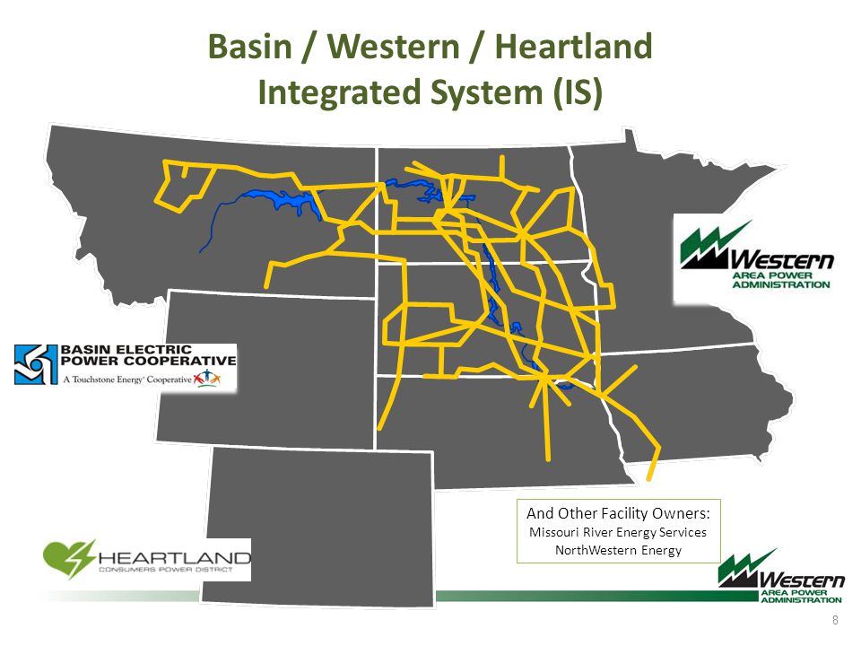
Ft. Peck is the largest earthen dam in the world! The Army Corps built a handful of dams on the Missouri, Ft. Peck, Tarrison (400 MW)(where we are now), Oahe (595 MW), Big Bend (468 M), Ft. Randall (320 MW), and Gavins Point (100 MW). Most of these are probably overdue for serious rehab.

Between all of these dams, there’s some serious power generation going on, but there’s also a problem with low water levels, putting generation at risk and requiring a FERC docket to address allocation. And of course, I was wondering where they sell the power, and it’s operated by the Army Corps to this day, and power is sold through the Pick-Sloan Missouri Basin Power Marketing Area and Western Area Power Authority (WAPA). Dispatch is supposed to happen out of a complex in Watertown, SD. Transmission out of Ft. Peck runs mostly east, but some to the west! From Ft. Peck, there are two 115kV lines, one 230 kV line, one 161 kV line, one 69 kV line, and one 34.5 kV line. Of the big collection of dams, there’s a transmission network moving the energy around:
Little is said about the impact of the flooding on the Assiniboine Nation, which met Franklin D. Roosevelt on August 6, 1934, to address those issues when he came out to cheer on the construction efforts. Now there’s “Ft. Peck” Reservation, north and east of the dam. The impacts of flooding on First Nations was part of the FERC docket regarding allocation, because a decrease in output and change in allocation will likely have an impact on local residents:
PICK-SLOAN MISSOURI BASIN PROGRAM Eastern …
From the “Answers” to comments, it seems FERC didn’t see it the same way:
And now we’re on to our second dam of the trip, Garrison Dam, and Ft. (not Grant) Stevenson, which has a great campground. Very nice, though sites are too close together. And once again, everyone has these huge rigs, some crammed in 3 to a space, circling the wagons, with a big campfire in the middle where they all hang out. I can’t help but snort, because many don’t know how to back up!!! There oughtta e a law, can’t back up — can’t go forward. And campgrounds accommodate these sorts of folks by making half the sites pull-throughs.
So anyway, on to the Soudan Mine and neutrino lab. How much fun can I stand?