Flyway Rest Stop in Goodhue County
March 31st, 2013
Just yesterday, I went for a drive in Goodhue County, wanted to get an eyefull of the area of Significant Biodiversity on the north end of the Goodhue Wind Project footprint, the part they’ve left out of all their surveys so far — it’s the purple area on the map below, pretty much along White Rock Trail (this is two maps combined to show biodiversity areas within footprint). The blue stars are new nests, three of which could be new eagle nests):

Map above: The red line is the boundary of the Goodhue Wind Project footprint. The dashed line is the area that’s supposed to be included in their surveys, the green diagonal lines are the Richard J. Dorer Memorial Hardwood Forest, and the purple are the areas of Significant Biodiversity.
When we were cruising around, we went into a little dip with running water on both sides in the ditch and lightly wooded, scruffy trees that were new growth, and along the ditches, in the trees, on the shoulder and even on the middle of the road were hundreds and hundreds of robins. I’ve never seen that many before, everywhere there were robins and they were singing up a storm.
Turns out Marie McNamara was driving around the same area, and found… are you ready?
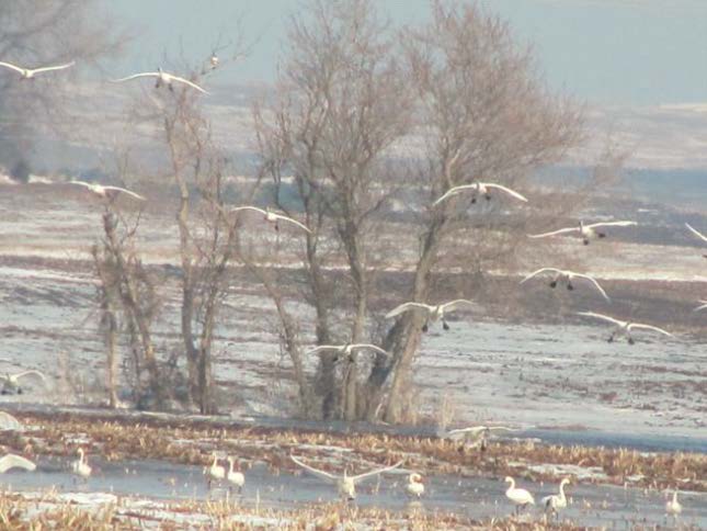
YES!!! TRUMPETER OR TUNDRA SWANS!
With any luck, the DNR will get out there and figure it out!