St. Louis area landfill burning near nuclear waste
October 23rd, 2015
This has been in the news a lot lately due to the Missouri Attorney General’s release of reports that are part of a lawsuit against the owners of the landfill, Republic Services, which, the AG states has “poisoned its neighbors’ groundwater and vegetation.” Great… just great… What I get out of this is that the fire’s movement towards the nuclear waste is a concern, but there are already significant problems in the here and now to deal with.
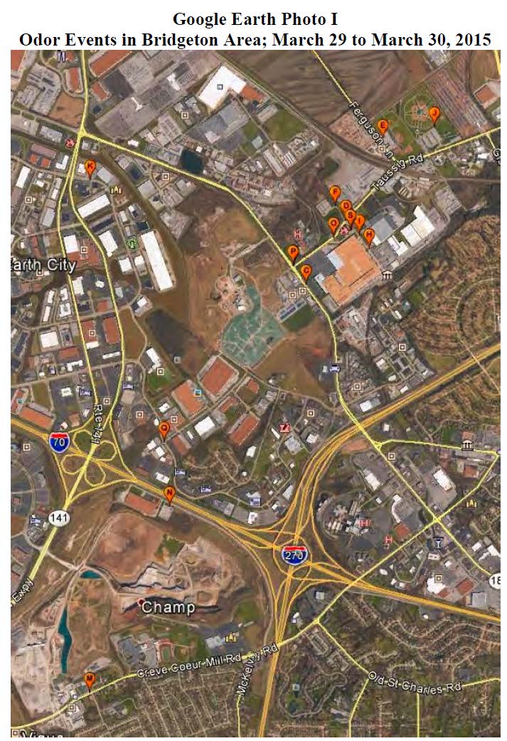
Site Q on the map above is right by the Candlewood Inn hotel that I stay at during BaronFest, held at the home of a friend in Maryland Heights just south of the bottom center of this map. Here’s Kady, settled into the hotel:

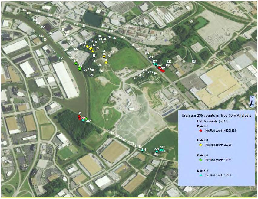
The reports released are pretty disturbing. Here are some maps from the Westlake Landfill Tree Core Analysis – Burken/Usman showing elevated U-235 in tree core samples:
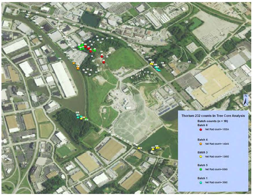
And here’s a similar map for Thorium, but note this concentration is to the north:
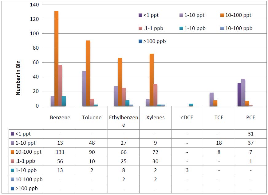
And from the same report, check out these carcinogens in the core samples:
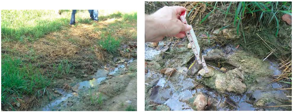
And from the Field Inspection Reports – Stark, visible leachate outbreak — it’s clearly not contained:
The primary documents from the Missouri Attorney General’s site:
- West Lake Landfill Organic Pollutant Phytoforensic Assessment – Burken
- Westlake Landfill Phytoforensic Assessment using Gamma Spectroscopy – Usman
- Westlake Landfill Tree Core Analysis – Burken/Usman
- Bridgeton Sanitary Landfill Groundwater Investigation – Price/Wronkiewicz
- Subsurface Self Sustaining Reaction Incident – Sperling/Abedini
- Bridgeton Sanitary Landfill Incident – Thalhamer
- Field Inspection Reports – Stark
- Bridgeton Landfill Downwind Odor Assessment – Wright
- Feasibility Study – Groundwater Remediation – Hemmen