Monday 6p – Silica sand at Goodhue PAC Meeting
November 16th, 2013
Monday, November 18, 2013 @ 6 p.m.
Goodhue County PAC Meeting
Silica sand ordinance
The packet for this meeting wasn’t posted as of Friday, so county staff sent it right away. Their system needs help, not only was the packet not on the county site, but on the “Events Calendar” it said the meeting time was 7 p.m. NOT GOOD.
But on the other hand, the packet has some glimmers of hope. It’s a hearing on the Save the Bluffs application for a Overlay District to protect natural resources. Here’s the packet:
PAC Report_Save the Bluffs Zoning Amendment Request 11-18-13
What’s on the table is EVERYTHING and then some:
- The original Application: Save the Bluffs’ Application for Zoning Ordinance Amendment
- The “Four Points” as presented in the Aug. 11, 2013 PAC Packet:
 There are later versions of these points, as Alan “pointed” out (cut and pasted):
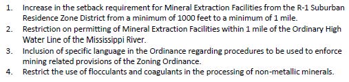
The MSC met on September 4, 2013 to discuss these requests. The Save the Bluffs representatives provided the following four items instead of the ones provided to the PAC: [Alan’s emphasis added]
1. 1 mile setback from high population areas, such as cities, hamlets, and residential subdivisions;
2. 1 mile [setback?] from the high water mark of the Mississippi – which protects the Great River Road and related tourism;
3. Prohibit the use of flocculants (or better yet, permit only dry processing); and
4. Set harsh penalties (such as canceling the permit) for violations.” [The Staff Report uses the above language.]
The items called out in the PAC agenda (“public hearing”) for Monday are different still:
a. No frac-sand operations (mining, processing, washing, trans-loading) within 1 mile of cities, R1 zoned districts, and campgrounds;
b. No frac-sand operations (mining, processing, washing, trans-loading) within a mile of the high water mark of the Mississippi;
c. Prohibit the use of flocculants in the washing and processing of frac-sand.(permit only dry processing so chemicals won’t get into surface or ground water and far less water is used), and;
d. Set harsh penalties for mining, processing and trans-loading violations (such as canceling the permit). The means of these different version seem similar but not identical and some of the differences could be important.
- The MSC’s Recommendation (remember, they’re merely ADVISORY, as is the PAC):
- Any combination you like, one from Column A, one from Column B… it’s wide open.
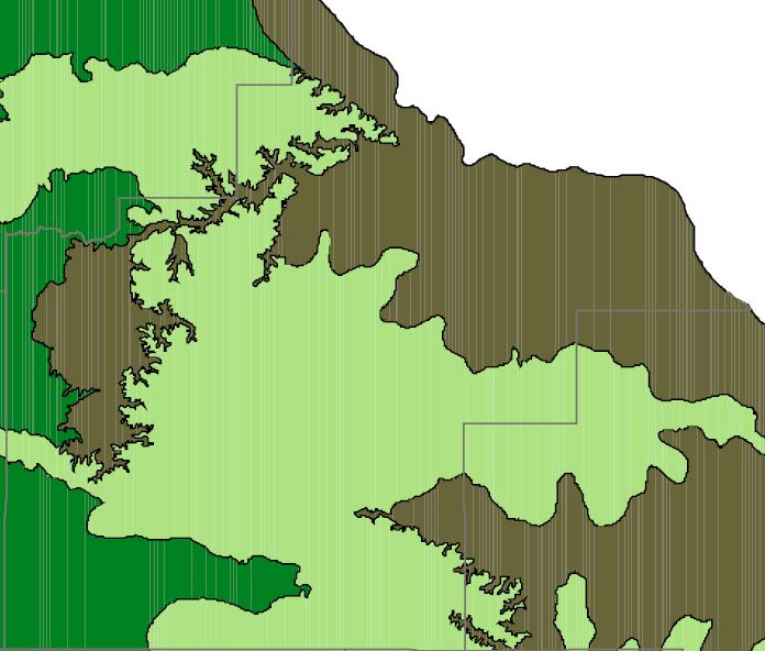
And I’m rather attached to that “Any combination you like, one from Column A, one from Column B…” option. First, the map, above. And there are more in the MSC Report. Here’s a map showing Setbacks, but it’s only PART of Goodhue County, we need the whole County mapped:

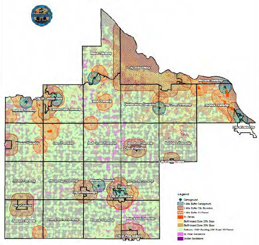
Here’s a map with the StB “four points” 1 mile buffers (why is this map such poor quality?):
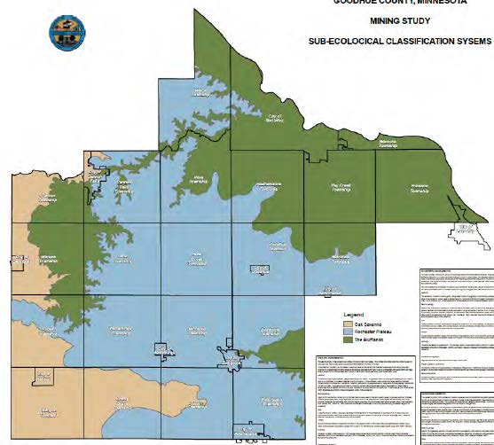
 And this map, showing the green “Blufflands” Sub-Eco Classification:
 And another showing public waters and blufflands (again, why is the quality of this map sooooo poor?):
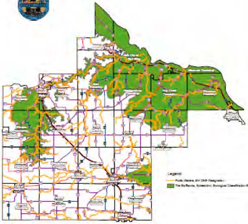 So “Any combination you like, one from Column A, one from Column B…” to me means to take these maps, put them together, and what do you get? Pretty good protections of the natural resources of our County!
This is a good start on the request of the original application. Not the be-all and end-all, but a good start!
Leave a Reply