Coal on the Wires – two 345kV lines coming in from out west – Transmission for Dummies #4
October 17th, 2005
What about “it’s for coal” don’t you understand?
It comes in from points west, like North Dakota and South Dakota, zips over to the 345kV ring around the cities, which, like a turnabout, shoots it out across the upgraded King-EauClaire-Arpin line, the Prairie Island-Byron line and the just announced Prairie Island-Roch-LaX line… a superhighway through Minnesota.
How many points does it take to discern a line? How many plants to discern a lie?
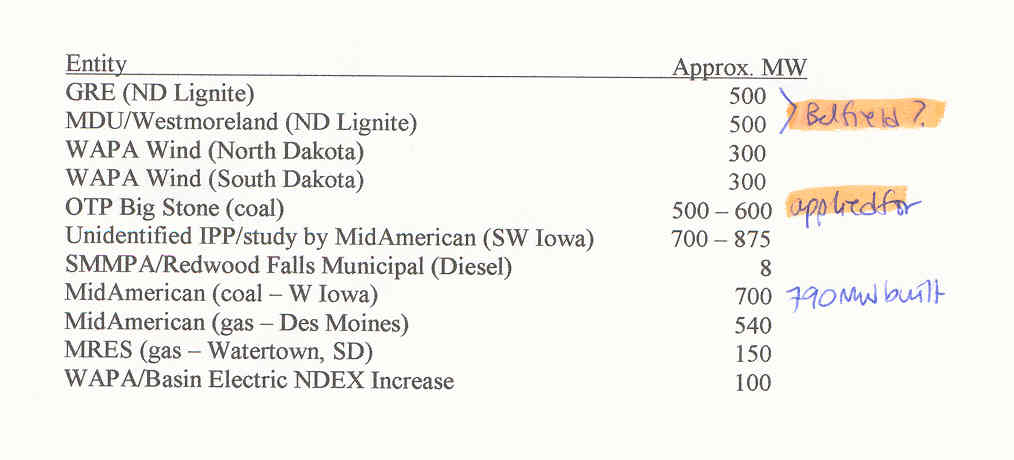
There’s the SW Minnesota Study with a listing of the coal plants to come on line…
There’s the Transmission Omnibus Bill from Hell.
There’s the announcement of 6 projects made possible by the TOBfH.
Download file
There’s the Big Stone II transmission application.
There’s the MTEP06 plan that says:
6.1 Regional projects or Study Areas of Focus:
? CAPX (Incorporates prior Northwest Area Exploratory Project) ? Three options are to
be pursued
1. Coal fields of North Dakota to Fargo to Benton County outside of the Twin Cities
2. Belfield, North Dakota (site of a new 500 MW coal plant) to Ellendale, South
Dakota to Big Stone area to Granite Falls to Blue Lake, Minnesota
3. Cross link from Ellendale to Fargo
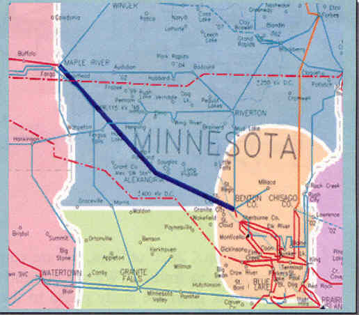
There’s the “coal fields of North Dakota to Fargo to Benton County” line:
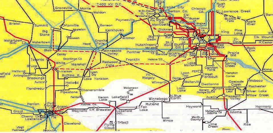
There’s the Belfield NEW COAL PLANT to Ellendale to Big Stone II NEW COAL PLANT to Granite Falls to Blue Lake:
Is something wrong with this picture?
Leave a Reply